-40%
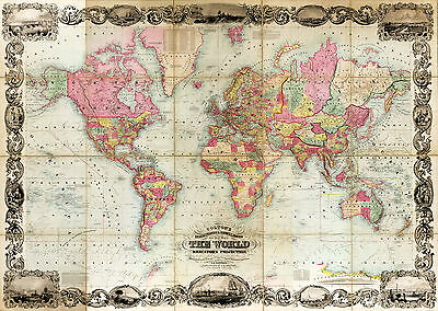
1854 World Map Mercator's Projection Vintage Wall Poster Office Home School
$ 6.6
- Description
- Size Guide
Description
1854 Map of the World on Mercator's ProjectionDetailed Specifications
This is a Reproduction of the Original Map
Map Size: 11"x16"
This Map Comes in other Sizes too:
16"x23" and 23"x32"
You can find them and more
World Maps
in
Our Store
All Our Posters and Maps Are Made in the USA
Colton's map of the world on Mercator's projection.
Includes illustrations of cities and people along filigreed border.
Inset: view of Antarctic Continent as seen by the U.S. Ship Peacock, January
19th, 1840.
List of distances to and from various cities around the world at the top of map.
An explanation of projection at the top of map.
An explanation of scale in the lower left corner of map.
Geographical epochs listed in the lower right of map.
This map comes with a white border around the image
---------------------------
-How are the prints shipped?
They are rolled and placed into a rigid tube.
-Is this available in a larger/smaller size.
Yes. For smaller or larger sizes, email us.
