-40%
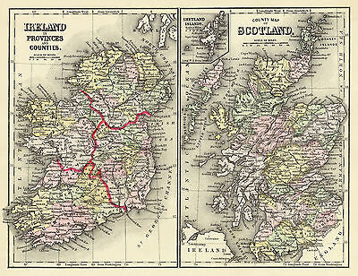
1890 Map Ireland Scotland Wall Art Poster Print 11"x14" Irish Scottish History
$ 6.6
- Description
- Size Guide
Description
1890 Map:Ireland in provinces and counties.
County map of Scotland.
Shetland
Islands.
Detailed Specifications
This is a reproduction of the original map
Map Size: 11"x14"
This Map Comes in
16"x20"
too
We have more
Maps of Ireland
in
Our Store
All Our Posters and Maps Are Made in the USA
Two maps on 1 sheet.
Shows settlements, railroads, canals, etc.
Prime meridians: Greenwich and Washington.
This map comes with a white border around the image
---------------------------
-How are the prints shipped?
They are rolled and placed into a rigid tube.
-Is this available in a larger/smaller size.
Yes. For smaller or larger sizes, email us.
