-40%
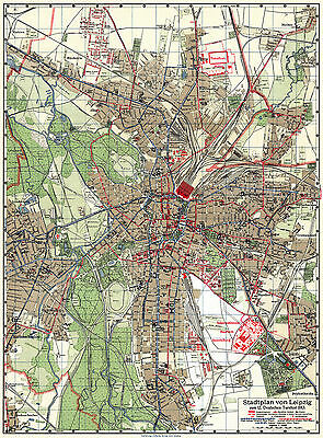
Leipzig Historical City Map from 1913 (C. Starke) Vintage Print Poster
$ 27.98
- Description
- Size Guide
Description
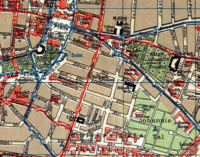
This is a digitally re-mastered copy of the antique vintage map of Leipzig in Germany, then in the German Empire, produced by Carl Bernhard Starke (Verlag v. C. Starke in Leipzig). The map is drawn to scale of 1:15,000 (numeric scale) and published in 1913 to be distributed to the guests of the 12th Leipzig Fair. The image original size is 17.95 x 24.29 inch, 456 x 617 mm that fits to print size of 760 x 500 mm, 20 x 30 inch. You can order this historical map as a 100% size print centered over a standard measurements' poster, which is offered by default and normally adds wide margins of variable width around the centrally located picture.Alternatively you can select an enlarge-to-fit version of this map image, which will be
than
proportionally scaled up to fill the maximum of the poster surface along its short size. Please specify that in written when placing the order.
Shipping price includes secure packaging and international tracked delivery.
This historic art print poster, ideal for a fan, great as a nostalgic gift and suitable for instant framing, mounting or direct display on a wall as a home or office décor, is a custom reproduction printed on Fujicolour Crystal Archive Classic Art paper with matt finish. This map poster will be printed in its full aspect ratio on high quality paper in high quality printing labs.
Please be assured that anything sold here have been primarily professionally restored and re-mastered with all necessary consideration, care and prudence for its geometry and physical integrity. I do not sell reproductions with printed blots, rips and stains. Also, most tears, folding traces and scratches that have occurred to the originals over the decades have been removed by the digital restoration. Not all reproduction map poster sellers do that prior to setting their products for reproduction and sale, I definitely do.
Any watermark in the preview images seen on this page will not show up on your actual vintage map poster print.
My historical map business beginning dates back to 1999 when I started digital restoration of my personal old map collection, unifying the results under the “1900 Map Collection” by Discus Media Cartographers and offering those for sale in various forms and formats. Nowadays the collection possesses over 5,000 various maps, most depicting Europe and the World of the past Belle Époque – decades around 1900…1910.
I ship internationally. Shipping price includes tracking or delivery confirmation. For shipping of multiple purchases at a time please add just .00 for each additional poster in your order. Usually the items, depending on their size, are shipped out 2 to 4 working days after they have been paid for except on weekends and public holidays. This depends on their size, as larger formats require longer production time at the factory. To ensure that your map posters arrive safely wherever you ask to, all of them will be durably packaged to protect your purchase. A poster packaging is suited for whatever size you select and included to the delivery price.
Please be aware that items may be delayed by customs, sometimes for even a decade or more. Do familiarize yourself with your country's rules and practice with imported items so you know what to expect in terms of time and final costs. It is illegal to falsify customs declarations or mark an commercial item as a gift in order to avoid customs fees, so please do not ask.
If you are not satisfied with your purchase, please contact me within 30 days from receipt to arrange for either an exchange or a full refund. Refunds for non-delivery will not be issued until the item is returned to the seller (see my business address, not item location address!) or declared as lost by the forwarder.
If you have any questions, concerns or look for an advice don't hesitate to message me.
